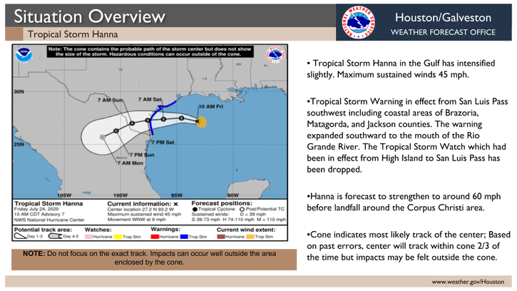
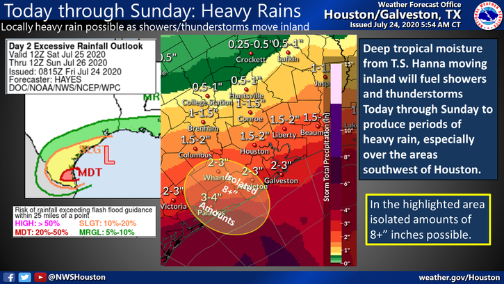
Fort Bend County Levee Improvement District No. 2 (FBCLID 2) continues to monitor Tropical Storm Hanna in the Gulf of Mexico. The FBCLID 2 pump stations have been tested and operators are on stand-by to run the pumps, if needed. Fortunately, the Brazos River and Ditch H are at low levels that do not impact drainage inside the FBCLID 2 levee. The latest forecast and information from the National Weather Service is included below:
“Tropical Storm Hanna is continuing to develop and move westward. We can expect increasing winds and seas across the Upper Texas Coastal waters today, and the threat of heavy rainfall spreading into Southeast Texas today and lingering through Sunday.…”
National Hurricane Center
National Weather Service
- Live graphic of levee operations
- 24-hour rainfall total
- Ditch water levels inside and outside the levee
- Brazos River Forecast (if flood stages are predicted)
- Pump Station operations
- Rainfall & stream gauges
- Live camera views with hourly updates
- Links to City of Sugar Land and Fort Bend County Emergency Management
FBCLID2.com/alerts
Residents are encouraged to sign up for email and text alerts through the District’s website to stay up-to-date on the latest news.