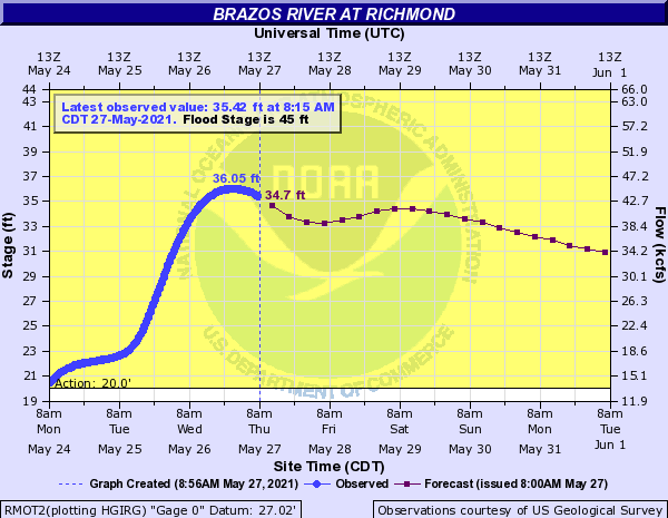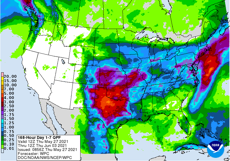
The Brazos River crested overnight at a river stage of 36 feet and is forecasted to remain around 34 feet until Sunday, May 30. At this elevation, the Brazos River begins to close the flood gates in the levee and restrict drainage inside FBCLID 2. However, a Brazos River stage of 36 feet is still low enough that heavy rainfall inside the District will push the flood gates open. Also, the District’s pump stations have been tested, and operators are on stand-by to run the pumps, if needed. The current forecast calls for ¼ – ½ inch of rain over the next 3 days and less than 1 inch of rain over the next 7 days. Based on the current forecast the pump stations will not need to be operated. The latest forecast and information from the National Weather Service is included below.
For additional information on FBCLID 2 Emergency Operations: FBCLID2.com/emergency
- Live graphic of levee operations
- 24-hour rainfall total
- Ditch water levels inside and outside the levee
- Brazos River Forecast (if flood stages are predicted)
- Pump Station operations
- Rainfall & stream gauges
- Live camera views with hourly updates
- Links to City of Sugar Land and Fort Bend County Emergency Management
Brazos River Gage at Richmond, Texas