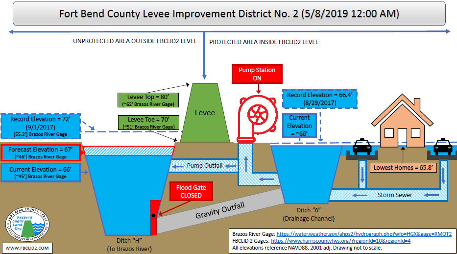
The following is a status update for Fort Bend County Levee Improvement District No. 2 (FBCLID2) Emergency Operations. FBCLID 2 received 8-10 inches of rainfall inside the levee over the past 24 hours. Both the Bill Little and the Mike Thelen Pump Stations are in operation and all pumps are running. The water elevation of the FBCLID 2 ditches inside the levee crested at an elevation of approximately 66 feet. At this level, flooding of homes is possible in the lowest areas of FBCLID 2.
The FBCLID 2 drainage ditches inside the levee were pumped down to the lowest possible level before the rain started. It will take two days to pump out all the rainfall runoff created by 8-10 inches of rain.
The Brazos River is forecasted to crest on Friday, May 10th near FBCLID2. The forecasted water elevation in Ditch H created by the Brazos River will remain 2-3 feet below the bottom of the FBCLID2 levee. However, additional rainfall is still forecasted through the weekend and all rainfall runoff must be pumped out of the levee. FBCLID 2 will continue to operate the pump station at full capacity throughout the duration of this event.
For additional information about FBCLID 2:
For additional information about Emergency Management:

