Do I live in Fort Bend County Levee Improvement District No. 2 (FBCLID 2)?
Click here for a map of Fort Bend County Levee Improvement District No. 2. Enter your address in the search box to locate your home.
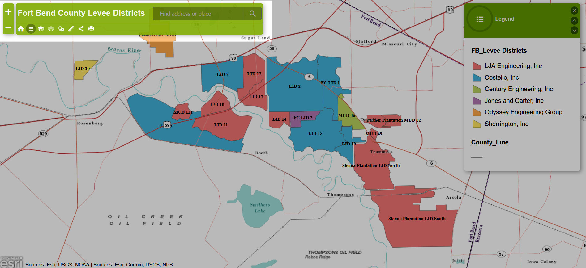
What Levee District do I live in?
Click here for a map of all Levee Districts in Fort Bend County. Enter your address in the search box marked below to locate your home.
How high are the levees in Fort Bend County Levee Improvement District No. 2 (FBCLID 2)?
The top of FBCLID 2 levee is 80 feet above sea level, which equates to a Brazos River gage in Richmond, Texas of 62.9 feet. During Hurricane Harvey, the Brazos River rose to 72.3 feet above sea level on the FBC LID 2 levee while the Brazos River gage in Richmond was 55.2 feet.
 How high is the Brazos River right now? How high will the Brazos River get?
Click here to see current conditions on the Brazos River at Richmond, Texas. During flood stages the National Weather Service website will also forecast future river conditions. The following is a view of the Brazos River gage at Richmond, TX during the 2016 Memorial Day Flood. The blue line is actual Brazos River level measured by the gage. The purple line is the is forecasted Brazos River level.

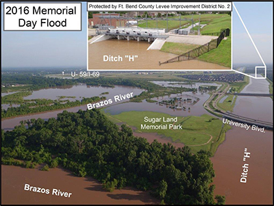
Brazos River & Ditch H (2016 Memorial Day Flood)
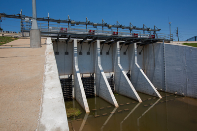
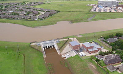
Who operates the FBCLID 2 flood gates in the levee?
Under normal operations, all rainfall runoff that falls inside FBCLID 2 flows out of the levee through large flap gates. These flood gates in the levee are opened and closed by gravity and water pressure. They are NOT operated by a person or machine. The flood gates will only close when the water level outside the levee is higher than water inside the levee.
Little Pump Station & Ditch A Inside Levee (2016 Memorial Day Flood)
Little Pump Station & Ditch A Outside Levee (2016 Memorial Day Flood)
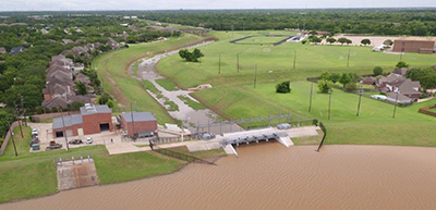
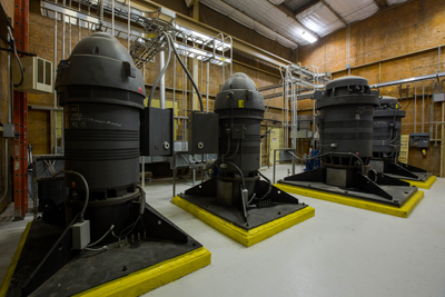
How do the FBCLID 2 pump stations work?
FBCLID 2 operates three pump stations: Bill Little Pump Station (Pump Station A), Thelen Pump Station (Pump Station F), and McDonald Pump Station (Third Pump Station). When the Brazos River floods, the water level closes the flood gates in the levee. When the flood gates are closed, all rain that falls inside the levee must be pumped out. When combined, the McDonald and Little pump stations can remove more than 1,500,000 gallons of water per minutes from Ditch A inside the levee.
The Thelen Pump Station can remove more 100,000 gallons of water per minute from Ditch F.
I live inside the FBCLID 2 levee. Should I buy flood insurance?
Yes! Many property owners may be unaware that private home insurance policies do not cover losses caused by rising flood waters. The common example of rising flood waters in Fort Bend County is created by the Brazos River, but FBCLID 2 was created specially to mitigate that threat. However, very strong, localized rainfall in any part of FBCLID 2 can potentially overwhelm the design standards of the drainage system and trap water in streets and yards, eventually reaching into homes. The damaged caused by this type of loss is not included in a standard home insurance policy and would only be covered by purchasing a flood insurance policy.
While not a common occurrence, localized rainfall of 12+ inches in a day has occurred and will continue to occur across Southeast Texas. In recent memory, Hurricane Harvey dropped more than 30 inches of rain in Sugar Land and more than 50 inches in parts of Harris County. Looking further back, the 2016 Tax Day flood dropped more than a foot of rainfall in portions of Harris County, and in 2001 Tropical Storm Allison dropped 40 inches of precipitation on parts of Southeast Texas.
FBC LID 2 encourages residents to check with your insurance carrier and discuss policy options for your property. For additional information check out www.FloodSmart.gov, the official website of the NFIP.
For more information: https://www.fema.gov/national-flood-insurance-program
What neighborhoods are located in FBCLID 2?
Alcorn Bend
Austin Meadow
Austin Park
Briarwood
Chimney Stone
Colony Bend
Colony Cove
Colony Creek
Colony Grant
Colony Meadows
Colony Oaks
Colony Park
Colony Woods
Cove at Crescent Lakes
Creekbend
Crescents on the Green
Cypress Glen
Cypress on the Green
Edgewater Bay
Edgewater Gardens
Enclave at Grants Lake
Enclave at Lake Pointe
Englewood Place Estates
Foxhall Crescent
Grants Lake Tempos
Grants Lake Townhomes
Lakes of Edgewater
Lake Pointe
Landing at Crescent Lakes
Landing at Grants Lake
Meadow at Crescent Lakes
Meadow Lakes
Oaks of Alcorn
Oyster Point
Park at Crescent Lakes
Settlers Grove
Settlers Parks
Stephens Grant
Sugarwood
Sweetbriar
Sweetwater
Sweetwater Court Townhomes
Sweetwater Estates
Sweetwater Townhomes
The Highlands
The Lakes
The Villas
Towns of Grants Lake
Travis Park
Williams Crossing
Williams Glen
Williams Grant
Williams Park
Woodstream