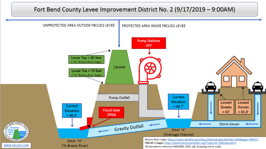
Fort Bend County Levee Improvement District No. 2 (FBCLID 2) is actively monitoring tropical activity in the Gulf of Mexico. Sugar Land is expected to receive several inches of rain throughout the week. Fortunately, the Brazos River is at extremely low levels that do not impact drainage inside the FBCLID 2. When the Brazos River is low the flood gates remain open allowing all runoff to drain out of the levee. The FBCLID 2 pump stations remain operational and staffed if conditions change this week. The Emergency Operations graphic describes the current status and water elevations for FBCLID2.
Email & Text Alerts
Flood Monitoring System
Flood gauges that monitor rainfall and ditch water levels.
FBCLID 2 Map
Locate your home and FBCLID 2 Levees, Ditches, and Pump Stations.
Additional Emergency Management Information